Accurate boundary information is critical. It helps the Census Bureau estimate your community’s population correctly, which affects how much federal and state funding your area receives. Here’s what you need to know about the 2026 Boundary & Annexation Survey (BAS) and the new Municipal Boundaries Tool.
What is the Boundary & Annexation Survey (BAS)?
The Boundary & Annexation Survey is an annual federal survey for tribal, state, and general purpose local governments (like counties, cities, and towns). The survey allows local governments to check the US Census Bureau’s information on their legal boundaries on record and submit recent changes like land annexations.
The 2026 BAS is launching soon and local governments will see some important changes as they reply.
Why Should Your Local Government Participate?
Current information about a local government’s legal boundaries is essential to accurately estimating that community’s population for various federal and state programs – programs that are used to distribute federal and state funds to localities.
If a local government’s boundaries aren’t up to date, the population count could be wrong. That means less funding for the community.
For example, if a town annexed land but the annexation information is unreported, the population in that part of the town would be excluded from official data. The resulting population underestimate may mean less federal and state funding to address local needs.
Hasn’t My Local Government Already Reported This Data?
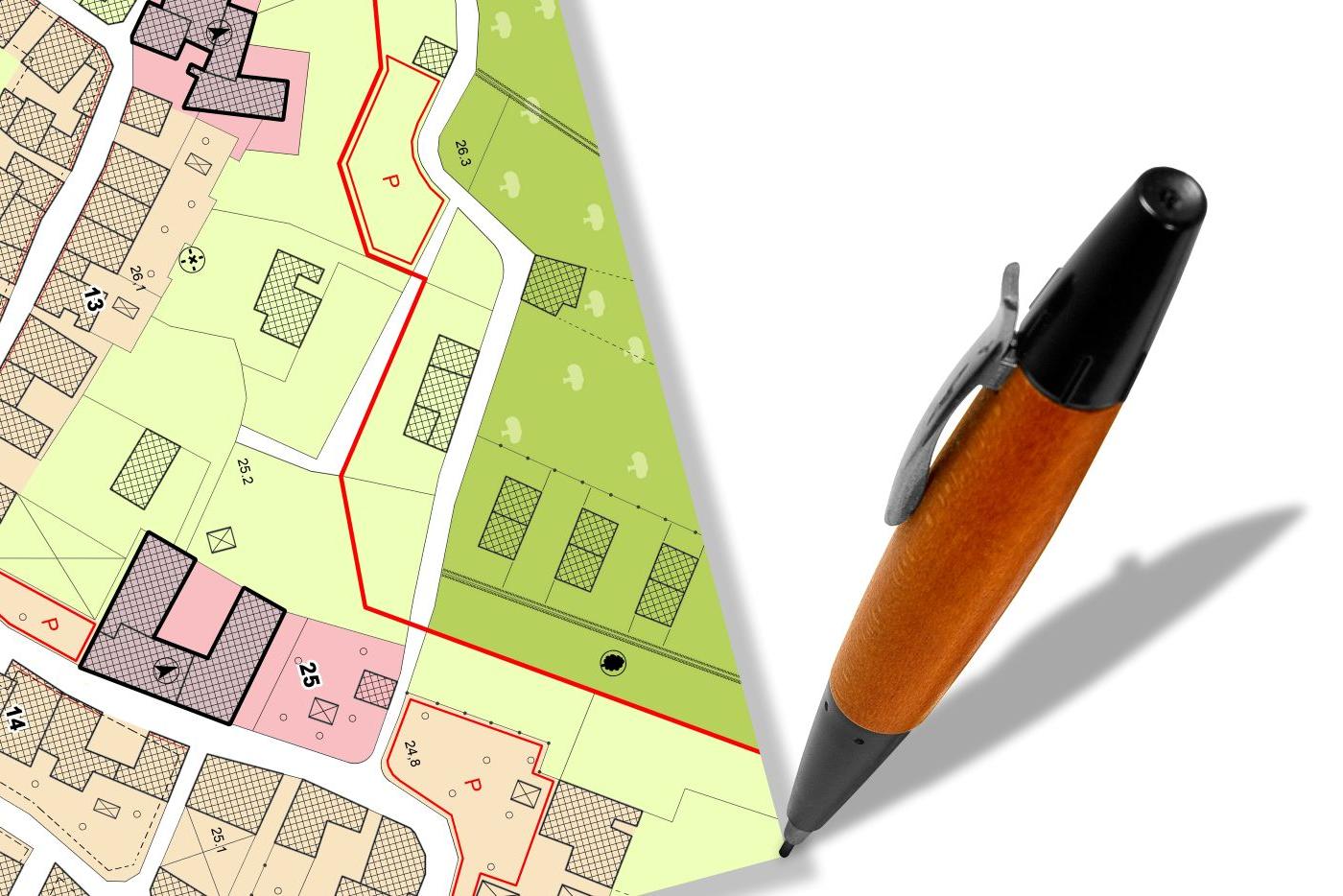
Local governments are required by state law to keep current boundary records with their clerks. When a local government annexes land, it should prepare an updated map, register the annexation with the applicable register(s) of deeds, and report the change to the Land Records Management Section of the NC Secretary of State’s Office. The Secretary of State’s office certifies the annexation and submits it to the Census Bureau. But many annexations go unreported because there’s no penalty for missing this step.
The BAS gives local governments a chance to confirm the accuracy of their data.
Key Dates for 2026
- January 1, 2026: This is the survey’s reference date—the date for which boundaries should be reported.
- February 2 (tentative): The Census Bureau will send materials to the highest elected official in each jurisdiction. There is no need to wait for this letter to reply!
- **** February 20: The state deadline by which local governments should verify information using the Municipal Boundaries Tool. Submissions received by this date will be part of the state’s priority submission to the Census Bureau. ****
- March 1: The Census Bureau’s priority response deadline. Information submitted by March 1 will be reflected in the current year’s versions of statistical programs like the American Community Survey and in the next BAS.
- May 31: The final response deadline. Boundaries reported after March 1 but by May 31 will appear in the next versions of statistical programs like the American Community Survey and the next BAS, as time allows.
What’s Changing for North Carolina in 2026?
The state and Census Bureau have made reporting easier for local governments with the new online Municipal Boundaries Tool. This effort to reduce the reporting burden was spearheaded by the NC Geographic Information Coordinating Council with this new “one stop” new online Municipal Boundaries Tool for the BAS.
Why Use the Municipal Boundaries Tool?
The online Municipal Boundaries Tool, which is part of the larger NC OneMap resource, is a single, authoritative source of municipal boundary data.
Instead of reporting to multiple agencies multiple times of the year, you can submit once and update four programs:
- BAS (Census Bureau)
- Powell Bill Funding (NC DOT)
- State Demographer’s Population Program (OSBM)
- Floodplain Mapping Program (DPS)
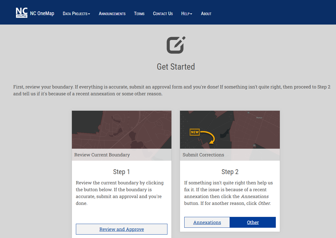
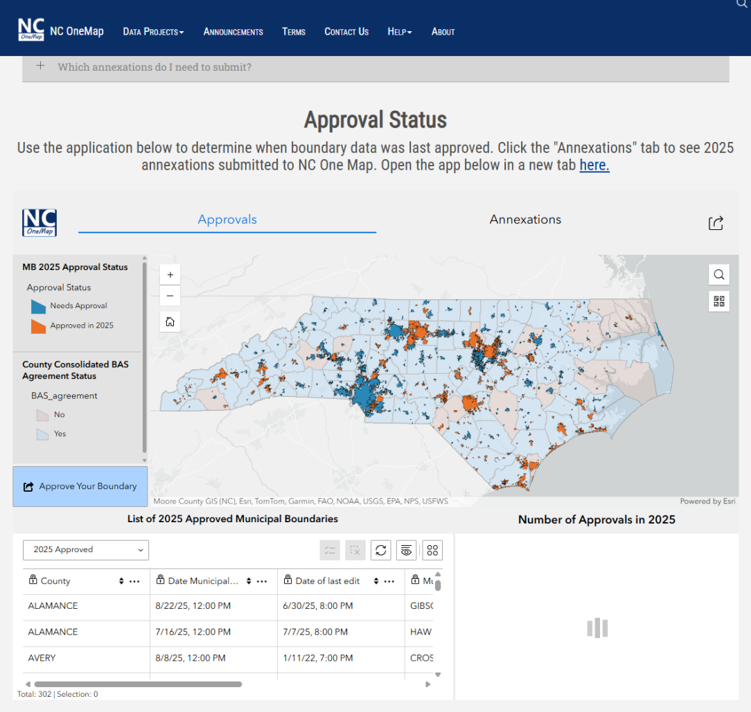
How Does My Local Government Use the Municipal Boundaries Tool?
A local government official can access the tool year-round to:
- Search for their jurisdiction
- Approve boundaries
- See when the boundaries were last approved
- See when the last annexation was submitted
- Submit annexations
- Make corrections
Detailed instructions are available within the tool and our BAS Guide from the NC State Data Center.
How Local Governments Should Respond to the 2026 BAS?
Starting in 2026, the preferred method is through the Municipal Boundaries Tool.
Local governments should approve boundaries by February 20 to be included in the state’s priority submission on March 1.
While the Municipal Boundaries Tool is the preferred way to respond, local governments may reply using the traditional response methods available on the Census Bureau’s website. Responses submitted using one of the traditional methods will be forwarded to the state to include in its statewide submission.
Doesn’t the County Already Do This for Local Governments?
Many counties have consolidated reporting agreements with their local governments. A county still may submit a single response for inclusion in the statewide filing.
However, local governments are ultimately responsible for their data and should use the Municipal Boundaries Tool to confirm their information is correct.
Where to go for more information
See our Guide to the 2026 BAS.